Thursday, August 10, 2023

About The Living Rock...


 The Dugandan -- 1998

(from left) Bryden Cais, Greg Sheard, Ian Thomas, Paula McCall (partly obscured), unknown, Celia and Chris Thompson, Wendy Steele (at end of table), Scott Stewart, Trish Hindmarsh, Keith Harper, Carola Henley and Ted Cais. Photo: Michael Meadows

THIS JOURNEY into Australian rockclimbing history began (above) on a warm Winter's afternoon in 1998 at the Dugandan Hotel, near Boonah. I was sitting around a table on the veranda of the pub with a group of friends, climbers, young and old. My school friends Greg Sheard and Ian Thomas were there as was Ted Cais with his son, Bryden. Ted and Bryden were visiting for another stint of climbing at nearby Frog Buttress from Ted's new home in the United States. Greg tossed a copy of Rick White's original climbing guide to the crag onto the table and the young climbers present pored over it as if it was the Holy Grail. It was clear that they valued this moment and the apparently insignificant, hand-stapled collection of words and images. It may have been at that moment that I realised that it was far more than a rockclimbing guide: it represented a historical moment in the origins of climbing in Queensland -- and beyond.

A defining feature of many of the crags that have become so attractive to climbers in Queensland and elsewhere in Australia is the presence of vegetation in multifarious forms — from the smallest algae and lichen to tenacious shrubs and even large trees. This ‘living rock’ is a central feature of Queensland climbing, particularly on the low-angled cliffs where Queensland climbing culture was invented. It is ‘living rock’ in another sense as well, defining the relationship between climbers and the vertical world we temporarily inhabit.
 
Mountaineer and former Italian Vice-Consul in Brisbane in the early postwar period, Felice Benuzzi, identified an element of this ‘Australian-ness’ in his vivid descriptions of climbing and the environment in the Glass House Mountains, north of the city. Felice had contacted the inimitable ‘spiritual father’ of Queensland climbing, Bert Salmon, who took the diplomat on several ascents in southeast Queensland in 1952. Following a climb up Caves Route on Tibrogargan, Felice and Bert were walking back to their car through a forest of Eucalypts. Oblivious to 60,000 years of Indigenous culture, the Italian diplomat mused on the Australian environment:

The huge smooth trunks of the trees don’t recall images of cathedrals or columns of ancient temples, even though the colour could perhaps evoke something like marble and travertine. The thought repudiates such comparisons. They just don’t hold up. They’re out of key in this world that seems lacking in history. Yet Bertie, who was born and who has lived here, doesn’t seem to feel this sense of vacuum, of emptiness; this lack of something that is so difficult to express. I don’t dare to confess to him my thoughts for fear of offending him. He loves this forest; he loves this Australia with a devotion of a son.

This particularly Eurocentric attitude was commonplace in 1950s Australia and yet it lingers today. Every aspect of landscape was inscribed into Indigenous cultures eons before First Nations people ‘discovered’ Europeans. Some have suggested that it is this unique, rich cultural heritage that should influence how we ‘imagine’ our own idea of climbing in Australia. It is anything but the ‘sense of vacuum’ that Felice Benuzzi described albeit this parallel world remains largely invisible to most non-Indigenous Australians. 

In the early 1990s, an influential figure in Australian rockclimbing history, John Ewbank, evoked the spiritual relationship between people and landscape by drawing on Indigenous concepts. He argued that the elements that make a particular location ‘sacred’ for Indigenous people — ritual, belief and tradition — should also be central to understanding Australian rockclimbing culture. While acknowledging the clear differences in interpretation and meaning between Indigenous and non-Indigenous cosmologies, he suggests an analogy: that the act of climbing can be seen as ‘turning a piece of rock into a sacred site’ and ‘it is then that we superimpose special values on it, even if these values are comprehensible only to other climbers’. He concludes:

I think it is becoming increasingly important for climbers to see cliffs and mountains within the context of a broader landscape and to realise that these outcrops, these ‘bones of the planet’ are already sacred, just as they are to many people other than climbers. 

Sadly, ignorance and/or denial of a history of Indigenous custodianship of places that include climbing destinations has skewed recent public debate around access to crags. The ‘loudest voices’ seem to ignore the undeniable Indigenous heritage that has resulted in these places being preserved for our enjoyment. For some, it seems, less a century of regular climbing activity can override 60,000 years of Indigenous history. 

But apart from a lack of engagement with this philosophical question, a majority of climbers who have railed against restrictions on access to ‘their’ crags do not seem to understand that it is Australian law that they are now challenging. The 1992 High Court Mabo decision effectively destroyed the legal fiction that Australia was an empty land — terra nullius — at the time of European invasion in 1788. The High Court decision — ratified in 1993 by the Australian Parliament — set up a framework for Indigenous land to be returned to the original custodians — in effect, a cohort of an estimated 250 different ‘countries’ (with 500 separate languages) at the time of European invasion. Despite popular media misrepresentations of the Native Title Act as some sort of ‘land grab’, the legislation was designed primarily to protect non-Indigenous property rights. In fact, the ‘land grab’ occurred at the time of European invasion and settlement.

Native Title claims are limited to vacant Crown land, waterways, and parks and reserves — and it is the latter that has created conflict with some members of the climbing community because it is where most climbing cliffs are found. It has taken decades, in some cases, for Indigenous people whose communities and economic structures were disrupted and destroyed by European invasion and settlement, to gather sufficient evidence to make a Native Title claim over a particular country — or what’s left of it. Once a claim is proven, under Australian law, the identified Traditional Owners have the right to maintain and protect sites, to use the land for hunting or ceremony, camp and live there, share in any proceeds generated by development of the land, and to have a say in land management and development.

This historical and legal context seems largely absent from the online climbing community discussions in recent years. What most don’t seem to understand that it is not ‘our’ land — it is Aboriginal land and the 1993 Native Title Act has inscribed that into Australian law. We have been trespassing — albeit for many, unwittingly — on Aboriginal land from the time the first Europeans began seeking out the heights. But the world has changed and as climbers, we must change with it and respect the rights of the Traditional Owners — and Australian law. 

Interestingly, there have been several instances of climbing cliffs developed on private land around the country — at least two in Queensland alone — where the owners have subsequently closed them down, refusing all access, mainly because of bad behaviour (loud voices, swearing, gates left open etc). Strangely, there have been no public outcries by climbers about these imposed restrictions to ‘save our summits’. Why not? Because we acknowledge private land ownership laws. Similarly, restrictions on climbing to iconic summits like Uluru and Balls Pyramid have largely been accepted — so why don’t we afford the same degree of respect and acceptance to Native Title holders who now have the same legal rights under the Native Title Act

On another level, sport climbing and its associated activities — placing bolts and the use of chalk — seems to have done a very good job of attracting unwanted attention by leaving permanent and semi-permanent markers on the landscape. To non-climbers — and the handful of those who have eschewed the use of these climbing ‘aids’ outdoors — it is evidence of disrespect, little different from defacing scenic areas with graffiti. Is this how climbers demonstrate ‘care’ for the environment? I have often wondered whether we would be even dealing with such issues now if the use of bolts and chalk -- and questions of access -- had been more discreetly managed. 

I am hopeful that wisdom, knowledge and good sense will prevail and that climbers and Traditional Owners will reach a compromise through genuine negotiation rather than confrontation or litigation to enable us all to share this amazing country by respecting these priceless resources. It is precisely this unique cultural heritage that sets Australian climbing culture apart from the rest of the world. So why not enlist Traditional Owners or their representatives to share creation stories of the places we visit; involve local Indigenous communities in existing (or new) climbing education and training activities and in the business structures that profit from access to these special areas; or incorporate local Indigenous cultures into climbing guides? 

We can do do better than we have done thus far. A lot better.


Tuesday, March 21, 2023

 Two Tassie summits and a classic climb


One for the surgeon: Ian 'Humzoo' Thomas testing out his recently-reconstructed knee 
on the classic climbing route, Apline - Whitewater Wall, Freycinet, March 2023


There has been a run of obituaries on this blog over past few months so I think it's time to celebrate the living. I had the great pleasure to travel extensively around Tasmania in March, 2023, with good friend and legendary climber, Ian 'Humzoo' Thomas. Ian had a knee reconstruction six weeks earlier and was keen to test it out on a few challenging summits - and the fabulous Whitewater Wall climbing route, Apline. His knee passed with flying colours.

The video embedded below captures our two summit climbs - Mount Victoria in northeast Tassie and Mount King William I in the southwest. It was a truly memorable journey and a testament to Ian's incredible persistence in re-discovering the fine physical form of his younger days. Our shared euphoria at seeing a cloud-free Frenchman's Cap - several times - with the southwest's extraordinary mountain landscape spread out before us was unforgettable. 

This is why we do it! 

The wonders and beauty of Tasmania's wild places are self-evident - it's the camaraderie and inevitable humour that always takes this to a new level.

Two Tassie Summits video (18:32)

Tuesday, January 31, 2023

Vale Will Steffen 1947-2023

Climate scientist, climber and climbing historian


Will Steffen (Photo courtesy Climate Council)


I didn't ever meet Will Steffen but I was aware of his extraordinary work in climate science and his perhaps lesser-known contributions to Australian climbing history. 


He became a resident of Canberra in 1977 when he moved from the US to take up a postdoctoral research position with the Australian National University (ANU). He spent 35 years exploring mountain regions of the world, rockclimbing and mountaineering on every continent except Antarctica. He was a member of the 1988 Australian Baruntse (7129 metres) Expedition, forced to retreat 100 vertical metres below the summit by dangerous snow conditions on a knife-edge ridge. An account of the expedition is available in The Himalayan Journal


Will had an abiding interest in Australian mountaineering, penning two surveys of Australian Himalayan climbing, along with profiles of prominent local mountaineers. His 2017 book, Himalayan Dreaming, is the most complete and best-researched document of Australian mountaineering, particularly on the heights in Asia. The book is available as a free download from ANU Press. Highly recommended! 


Will Steffen was also an outstanding and outspoken climate scientist whose influence spread globally. Formerly Executive Director of the Climate Change Institute at the ANU,  in more recent years he served as a Climate Commissioner on the not-for-profit Climate Council - an organisation started in 2013 when the conservative federal government under Prime Minister Tony Abbott disbanded the Climate Commission within days of being elected to power. He also worked with numerous international climate research bodies. 


Will was a passionate advocate for recognition of the level of human intervention driving climate change globally. Described by his many supportive colleagues as a leading thinker, optimistic and kind, he once wrote in response to student demonstrations against the lack of action against climate change: 


The students are right. Their future is now being threatened by the greed of the wealthy fossil fuel elite, the lies of the Murdoch press, and the weakness of our political leaders. These people have no right to destroy my daughter's future and that of her generation. 

(cited in The Guardian)


Following a battle with pancreatic cancer, Will Steffen died peacefully in Canberra with his wife of 51 years, Carrie, and his daughter, Sonja, by his side. He was 75.


Other tributes and background


Renew Economy: clean energy news and analysis

The Guardian

Wikipedia

Planet Politics Institute

Climate Council

Sunday, December 25, 2022

Climbing Logan's Ridge with a legend...

 Mount Barney: 21 December 2022


I had the great privilege of visiting Mt Barney with pioneering climber and adventurer Alan Frost. I doubt that anyone else has made the ascent of Logan's Ridge, aged 87 years and 9 months...and he's not done yet! 


VIDEO: Alan Frost climbing Logan's Ridge on Mt Barney -- the best mountain in Australia!


Tuesday, August 16, 2022

Vale Rod Bolton: adventurer, photographer, climber

Rodney Frank Bolton 

22 July 1943 - 20 July 2022


Early in 1970, Rod Bolton accepted a commission from noted Queensland climber Rick White to produce a short silent Super 8mm movie of Rick and his then climbing partner, Ross 'Cecil' Allen, making the 2nd ascent of the climbing route, 'Odin', at Frog Buttress. 'Odin' was at the time one of the hardest routes in Australia and certainly amongst the most strenuous, requiring superlative jamB-climbing skills and a high level of energy. Rick White had both and it was these elements that Rod captured in the historic four-minute movie he created. It is a rare glimpse of the climbing style that defined that particular clean-climbing era in Australian rockclimbing history. Hanging on abseil lines beside the climbers and with a second camera unit in action on the day, the skilfully-edited short film was affectionately dubbed Deep Purple on Rock by Rick, a longtime fan of the British rockers, Deep Purple (and of the colour purple), and screened to disbelieving climbers in the southern states in the early 1970s accompanied by Deep Purple's booming anthem, Smoke on the Water


Rick White starts the 2nd ascent of 'Odin' in 1970 (Rod Bolton collection)


Rod Bolton (left) hangs on an abseil line filming Rick White's 2nd ascent of 'Odin' at Frog Buttress in 1970
(Rod Bolton collection)


Rod was something of a polymath with climbing included in his set of diverse outdoor interests. His name appears on several new routes in southeast Queensland in 1969: on the now banned Glass House Mountains pinnacle of Crookneck ('Stairs', climbed with Rick and Alan Brown) and a memorable Frog Buttress contribution, 'Chocolate Watchband', again climbing with Rick. 

Born in London in 1943, Rod soon discovered his interest and skill in building and repairing, starting with model aircraft, some with tiny diesel engines and even one with a pellet fuel-powered jet engine. By the time he was 13, through Scouts, he discovered a great love of the outdoors. He started work at British Railways as an apprentice electrician, repairing vacuum cleaners on the side often using materials salvaged from the scrap bins at the train yards. Like his climbing contemporary in Australia - Ted Cais - albeit years earlier, Rod successfully directed a small electrical current through a doorknob to 'shock' the lowly apprentices when they grabbed the handle. This sense of humour was a theme that ran through his life.

Like many previous climbers, Rod was into motorbikes as a teenager and frequented local haunts on his beloved Norton Dominator. He was definitely a 'Rocker' in the age of 'Mods' and 'Rockers' - the Swinging Sixties - modelling his hair style on a youthful Marlon Brando who came to fame in the cult movie, The Wild One. One of Rod's challenges was to put on a three minute-long vinyl record and race his bike to an appointed place in town, trying to make it back before the song finished. And again, like earlier daring climbers in Queensland (Bob Waring in particular), he was fascinated by the Isle of Man TT motorcycle races, once completing a lap with one of his mates as pillion in 46 minutes! His earlier contemporary, Bob Waring actually entered the race one year in the early 1950s and was in third place when he had to withdraw with engine trouble!


Rod on the summit of Beerwah, Glass House Mountains, in the late 1960s (Rod Bolton collection)

In 1964, Rod emigrated to Australia, along with several of his friends as '10 pound Poms', ending up in a share flat at Kangaroo Point in Brisbane after driving north from cold, miserable Melbourne in a Khombi van. 


An Adventurers' Club outing on Tibrogargan in 1969 - Alan Milband (with the rope) instructs beginners
on an ascent of Caves Route (Rod Bolton collection
)


Rod abseiling on the lower slopes of Mt Beerwah in the Glass House Mountains on an Adventurers' Club excursion in 1969
(Rod Bolton collection)


Alan Milband leading boldly in Volley OCs on Tibrogargan - Adventurers' Club outing 1969 (Rod Bolton collection)

A few years later he joined the Adventurers' Club, a group of outdoors' enthusiasts who met regularly at a refurbished boathouse on the banks of the Brisbane River at Kangaroo Point. It was through this active organisation that he met Rick White who had been engaged by the club as a climbing instructor. He also met up with ex-pat Welsh climber Alan Milband and local Ian Cameron, both featuring in bold early ascents in southeast Queensland - Alan on the 3rd ascent of the East Face of Mt Barney (with Greg Sheard) and Ian on many of the early 1st ascents at Frog Buttress (with Rick White). Rod was a highly skilled photographer and worked for some years as a camera repair technician, drawing on his extraordinary engineering skills. In more recent years, both Rod and Ian joined a growing number of backyard native bee keepers with several hives of the curious little stingless insects between them.


Rod with Alan Milband on the summit of Tibrogargan in the Glass House Mountains in 1969 (Rod Bolton collection)

I reconnected with both Rod and Ian through my research for climbing history book, The living rock, and my own interest in native bees. Rod and Ian had planned a visit to my place to split one of my hives when COVID struck in 2019, grounding us all temporarily. Although I never climbed with Rod, his infectious good humour and his extraordinary attention to detail will forever stay with me. 


(from left) Alan Brown, Rick White and Rod on the summit of Coonowrin, Glass House Mountains,
probably after their 1st ascent of the climb, 'Stairs', in July 1969.

When Rod was diagnosed with aggressive pancreatic cancer a few months ago, his typically throwaway response was simply: 'Shit happens.' His experiences are emblematic of so many of us who comprise the climbing-outdoors community. All of us have lives, families and friends beyond the crags and for me, his story underlines the broad spectrum of 'ordinary' people who comprise the Australian climbing/outdoors community. The vast majority of us will never find our names aligned with terms like 'the longest', 'the hardest', or 'the best', but it explains one of the great appeals of exploring the outdoors in whatever form we choose: each of us is able to have our own unique, intensely personal experiences that can - and usually do - enrich our lives. Crossing paths with Rod has enhanced this process for many of us. 


Rod on an early ascent at Frog Buttress in 1969


Ian Cameron (belayed by Rod) searching for a suitable 'cracker' placement on the 1st pitch of Carborundum
Tibrogargan, 1969 (Rod Bolton collection)


A smiling Rod Bolton (centre rear with beanie) oversees a stretcher party carrying his friend, Alan Milband, seriously injured in a fall on Mt Barney's West Peak in 1969.
Greg Sheard (front left) leads the rescue team to glory (The Courier-Mail, Rod Bolton collection)


Saturday, May 14, 2022

TWO TRIBUTES TO WOMEN ON THE HEIGHTS

Vale Cecily Fearnley 1925-2022

The photograph (below) of local pioneering climber-bushwalker, Cecily Fearnley, was recently sent to me by a family friend and with permission, I'm posting it here. A passionate and award-winning environmentalist and museum artist, Cecily was founding vice-president of the Brisbane Bush Walkers in 1949. She passed away in January, 2022, just before her 97th birthday. I had the good fortune of meeting Cecily -- known as 'Noosa's natural living treasure' -- in 2016 at the Noosa Library when she attended a presentation I gave on local climbing history, based on my research for The living rock. I recall that she was the first to arrive and the last to leave that day and we spent time talking about her various ascents in the Glass House Mountains in the 1950s and 1960s. While it is sad that another of our pioneering women has moved on, the environmental legacy she has helped to create will remain.


Cecily Fearnley climbing in the Glass House Mountains ca. 1950 (Photo: Fearnley family)

Online acknowledgements and tributes to Cecily Fearnley:

Australian Encyclopedia for Science and Innovation 

Noosa Today 

Noosa Parks Association 


*****

History's forgotten female mountaineers...


And while on the topic of women on the heights, I've just finished reading a wonderfully illuminating study by British researcher Clare Roche on the hidden and largely ignored history of female climbers in the Alps at the end of the 19th century. As I discovered myself in researching the history of rockclimbing in Australia, women played a far more central role here -- particularly in southeast Queensland -- than had previously been acknowledged. It underlines the general sidelining or ignorance of women's achievements across a broad spectrum of society, a process that largely continues today despite the best efforts of some to challenge male dominance. The evidence for this is overwhelming for anyone who cares to look beyond the status quo (largely controlled by men) and this well-written and accessible account of women exploring the Alps is another excellent example. It takes us beyond the endless array of mountaineering publications that largely replicate each other in terms of a lack of acknowledgement of the role played by women in the development of European mountaineering. 

Who knew about the number of first ascents in the Alps by women, on occasion in advance of men? Who has heard of the pioneering female mountaineers who explored the heights at a time when Victorian era women were defined as -- and assumed to be -- 'the weaker sex'? For those with an academic and/or theoretical bent, there is much in this thesis in relation to women's agency and how middle-class Victorian women redefined perceptions of the female body through their engagement with the mountains. The overall historical narrative is uplifting and I highly recommend it to anyone who is interested in this fascinating and under-acknowledged aspect of mountaineering history.

Link to a PDF of Dr Clare Roche's thesis


Wednesday, March 09, 2022

Vale Bryden Allen

Bryden Allen 

28 February 1940 -  9 February 2022


Bryden Allen climbing Toyland (25) in the Blue Mountains in 1998 at age 58
Photograph: Simon Carter

Bryden Allen was arguably the foremost figure in postwar Australian rockclimbing, pushing the boundaries on bold new routes throughout the 1960s and 70s that today still demand the highest respect. Despite becoming paraplegic following a fall when approaching a climb at Mt Arapiles in 2000, Bryden maintained his close connection with the Sydney climbing community, often belaying from his wheelchair. One of his regular climbing partners from the early years, Keith Bell, reflects on this giant of Australian rockclimbing culture and on the extraordinary persistence and drive that Bryden refused to let interfere with his life following his accident. Read Keith's tribute to a truly eccentric and inspirational person...Bryden Allen obituary

Tuesday, January 18, 2022

IAN RODERICK MCLEOD MBE

26 July 1931— 12 September 2020 


QUIET ACHIEVER - GEOLOGIST AND PIONEER LEADER 


Ian McLeod’s first exposure to geology was in 1945 through his spur-of-the-moment decision to choose it as his matriculation elective, rather than geography. Inspired by his geology teacher, and fascinated by the subject, he majored in geology at university and so embarked on a lifelong career in the earth sciences.


Ian was born in Rockhampton, Queensland (Qld), in July 1931, and did his primary schooling there and in Brisbane to where his parents moved in 1940. He did his secondary education at  Brisbane Grammar (1945—1948), completed his BSc at the University of Queensland (UQ) in 1951 (with distinctions in geology in all three years), his BSc Hons in 1953 (on the geology of the Monsildale district, Qld, with First Class Honours), and his MSc in 1955 (on the geology of the Somerset Dam Igneous Complex, Qld), while working part-time in the Geology Department as a demonstrator and research assistant throughout the years 1953-–1955.


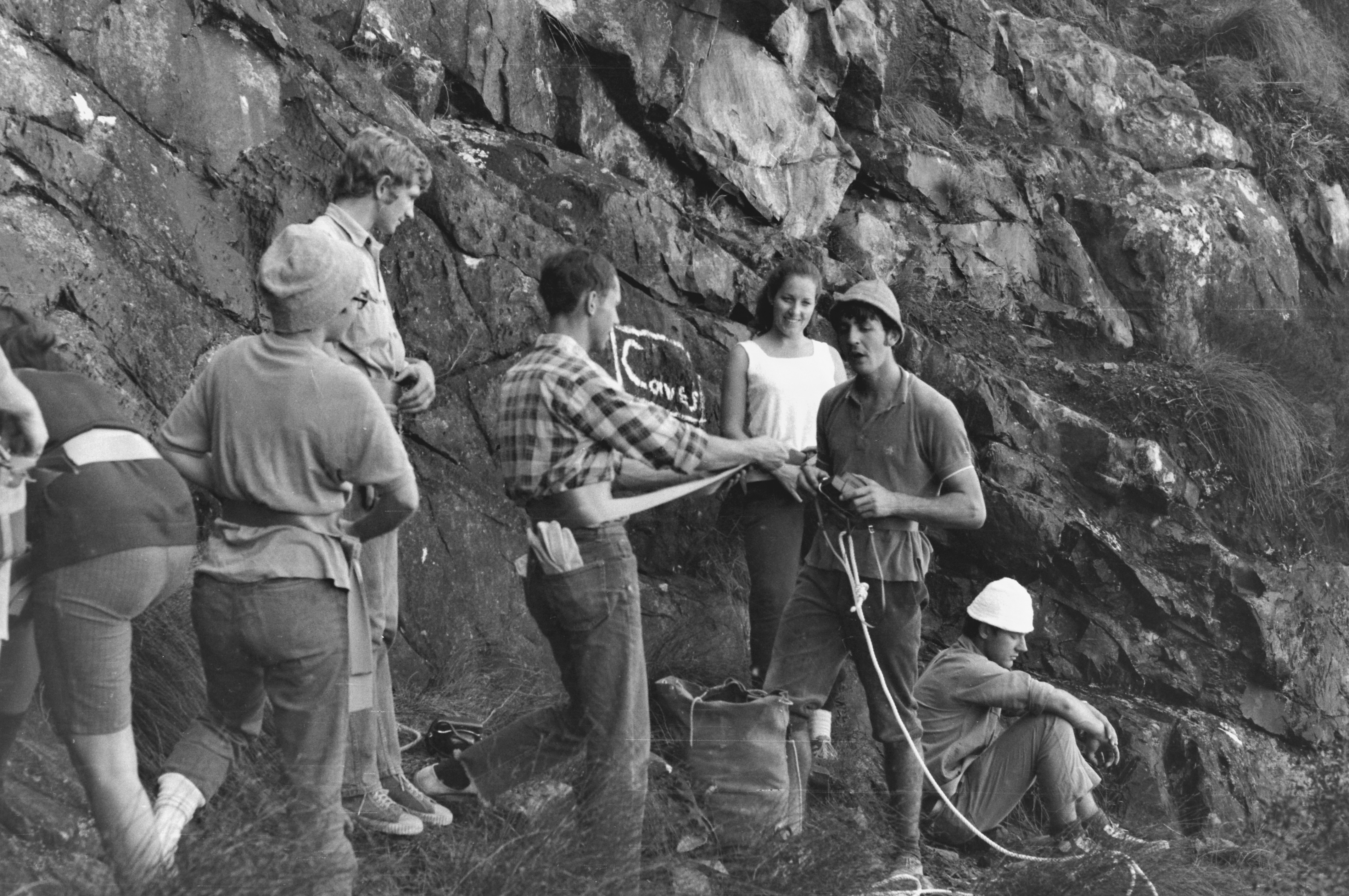
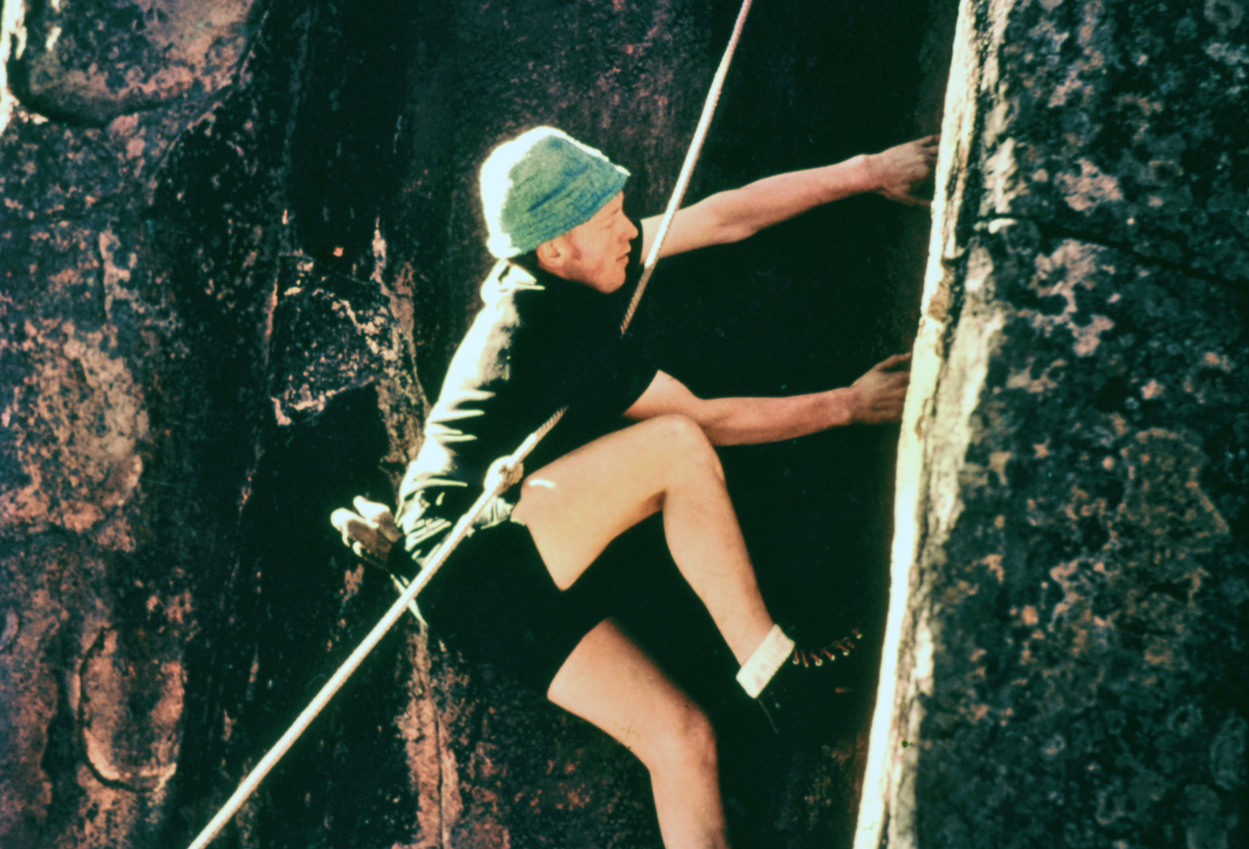
Most significantly, Ian’s experience at UQ was not solely an academic adventure in the exploration of science but was also a time of outdoor adventure exploring the wild mountainous landscapes of southeast and north Qld in company with similarly intrepid members of the University of Queensland Bushwalking Club (UQBWC), including, notably, his geology classmate Jon Stephenson (who had co-founded the Club in April 1950, and of which Ian was President in 1955). Their first major, and truly epic adventure together, with four other Club members, was to the huge granite massif of Mt. Bowen on Hinchinbrook Island in north Qld in early January 1953 (i.e., at precisely the wrong time of the year, being in the middle of the monsoon, but the only time available to them). They were dropped off by boat on the east coast of the island below Mt. Bowen, and in two separate groups of three, with McLeod in one group and Stephenson in the other, they made consecutive (probably the third and fourth) ascents of Mt. Bowen (1,121 m), by very different routes; and, variously, ascents of several of Bowen’s satellite summits, including the first ascents of three of these, one of which was the formidable tower-like pinnacle known as the Thumb (climbed by Stephenson’s group). Amongst the numerous difficulties they encountered during their 11-days on the island were “36 inches” (more than 0.9 m) of rainfall during the last nine days, flooded creeks, and (enabled by a spring tide) “surf [enlivened by floating logs washed down by the Herbert River] rolling a hundred yards into the jungle”, forcing them inland from the coast through “pack-deep mangrove swamps” (wary of crocodiles) and “dense Jungle” in order to reach their arranged contingency pick-up destination (i.e., in the event of bad weather and rough seas) at the south end of the island. These and other wilderness- and contingency-survival experiences and climbing skills gained during their time at UQ stood both Ian and Stephenson in good stead for the even greater adventures and challenges of their subsequent individual fieldwork careers, notably in Antarctica (and in Stephenson’s case, also in the Karakoram and the Sub-Antarctic). 


The January 1953 UQBWC Hinchinbrook Island team. From left to right: Geoff Goadby, John Comino, Ian McLeod, Jon Stephenson, David Stewart, and Geoff Broadbent. Photo: John Comino collection, courtesy of Rankin Publishers.


In January and February of 1955, during the UQ summer recess, Ian and several other students with geological training from the UQ were employed by the Tasmanian Hydro-Electric Commission (HEC) to map the geology of the Mt. Fincham area (Map Square 3780) of the western Tasmanian wilderness, supported by fortnightly airdrops. This is a rugged and thickly vegetated region centred on the Engineer Range and taking in the Franklin River on the east and the King River and Andrew River valleys on the west. Many years later Ian realised that that work was of relevance to the HEC’s long-term plans to build a dam on the King River, the King—Andrew catchments divide, and possibly the Lower Gordon River.


In early 1956 Ian joined Reg Sprigg’s company Geosurveys of Australia which (probably through a subsidiary company), jointly with the International Nickel Company of Canada (INCO), was exploring for nickel in the far northwest of South Australia and adjoining region of Western Australia (10 years prior to the subsequent nickel boom). Ian was deployed on this project, focused primarily on locating nickel-bearing layers in the layered mafic—ultramafic Giles Complex, whose impressive but previously little-known rocks, and extensive high-quality exposures, he described as  “breathtaking”. This work in Central Australia was undertaken at a time when there were effectively no roads there (except for some rough tracks developed in the 1950s for the Woomera Rocket Range and atomic bomb test-sites at Maralinga), no fences, no topographic maps, and when small groups of indigenous people, still virtually untouched by contact with Europeans, were sporadically encountered pursuing their traditional nomadic lifestyle. The fieldwork was facilitated by specially flown air-photos and almost all travel throughout the region was cross-country. The exploration included the first use of airborne electromagnetics (EM) in Australia (using technology that at that time was still being developed by INCO), with follow-up ground EM and diamond drilling. An extension of this work to the south beyond the Giles Complex to check out some unusual patterns on the air-photos discovered the yet-to-be-identified Officer Basin.


Ian McLeod (centre) on-board the ANARE supply ship Magga Dan, with the Honourable Richard Casey DSO, MC, CH (at right), Minister for External Affairs, farewelling the ship and Phillip Law, Director of the Antarctic Division and Leader of ANARE. Port Melbourne, 5 January 1960. Photo: Australian Antarctic Division archives.


In late 1957 Ian joined the Bureau of Mineral Resources in Canberra (BMR; now Geoscience Australia) and was initially deployed as a geologist and glaciologist in a cooperative program between the BMR and the Australian National Antarctic Research Expeditions (ANARE; now the   Australian Antarctic Division) to work in East Antarctica for a year, based at Mawson Station. He arrived at Mawson on the annual supply ship Thala Dan on 10th February 1958, having undertaken reconnaissance geology along the coast of East Antarctica en route at Lewis Island (Wilkes Coast) and in the Larsemann Hills near Davis Station (Ingrid Christensen Coast). But the ship spent little or no time at Mawson and took expedition leader Phillip Law, Ian, and fellow geologist (and 1957 over-winterer) Bruce Stinear on a reconnaissance trip for the rest of the month to Amundsen Bay ca. 565 km west of Mawson but had difficulties making landings. 


Upon the ship’s return to Mawson Ian was involved with unloading operations and familiarising himself with the Base and its surrounds, and throughout March and April, together with four others, he undertook glaciological fieldwork inland from Mawson based in a sledge-mounted caravan. This involved conducting a seismic traverse across the ice-flow direction to determine ice thickness, measuring movement rates, and gathering other glaciological data. In the mid-1950s, such glaciological work on the Antarctic icesheet was still at its infancy but was also being conducted concurrently and in the prior year on the opposite side of the continent by the Commonwealth Trans-Antarctic Expedition (1957—1958) in which Ian’s former UQ geologist class-mate, Jon Stephenson played a major scientific role, 


Wintering over at Mawson was a busy time for everyone, including Ian. In addition to compiling, plotting, and analysing field data and writing reports, and conducting daily measurements of snow ablation rates, sea-ice thickness, doing occasional penguin counts in the local rookery, etc., numerous other camp-duties had to be done on a regular basis, including hut ‘slushie’ duties (daily roster) and camp slushie duties (weekly roster). These duties were very numerous, and included janitorial work comprising general cleaning of the accommodation huts and communal facilities, replenishing the snow and coal supplies to the huts and kitchen, human waste disposal from the huts and communal toilets, and waste disposal from kitchen, mess room, and camp generally, plus nightwatchman duties. But in Ian’s and his surveyor colleague, Graham Knuckey’s, case, they also involved planning and preparation for a major dog-sledge expedition to be undertaken in the coming summer, involving two sledges and two dog teams to be driven by them, and the responsibility of looking after the sledge dogs who would make it possible. This demanded much time and effort throughout the winter and spring and involved finding and fetching the dogs’ food (i.e., sealing), feeding them, exercising and training them, cleaning their tether lines, and combing their coats to remove accumulated ice. 


Ian McLeod with sledge dog Lewis, Enderby Land, Antarctica, December 1958. Photo: Geoscience Australia archives.


On 27th September Ian flew to Beaver Lake in the Prince Charles Mountains to investigate establishing a base there from which air-supported reconnaissance mapping and glaciological fieldwork could be conducted, and spent time there again from mid October until early November establishing a camp and undertaking preliminary fieldwork.


The dog sledging journey commenced on 27th November when the last of the dogs were flown to its starting point. The two Beaver aircraft based at Mawson had been used during the previous days to lay two intermediate depots of supplies on areas of exposed rock along the planned route from Amundsen Bay back to Mawson, and to transport the men (including the third member of the expedition, radio operator Peter King), dogs, equipment, and food to Amundsen Bay, landing on the sea-ice offshore of and below the terminal escarpment of the continental icesheet, the ascent of which constituted the first obstacle of their journey.


The geology of the hinterland region south and west of Mawson (Mac.Robertson Land, Kemp Land, and Enderby Land) was almost unknown in 1958 (and much of it unknown geographically too). It includes the Prince Charles Mountains and isolated massifs and nunataks stretching from 300 to 800 km south of Mawson and has one of the highest proportions of exposed rock of any region of the continent. Consequently, the sledging expedition from Amundsen Bay back to Mawson constituted a pioneering reconnaissance mapping exercise through a region of virtually unknown topography and geology aided by very limited (oblique) air-photos. The expedition arrived back at Mawson on 21st January 1959, 54 days after it started, and having covered 650 km. Ian departed Mawson for Australia on the annual supply ship a few weeks later but managed to collect water samples and sediment samples from the hypersaline lakes in the Vestfold Hills near Davis Base when the ship visited there on 17th February, the analyses of which, together with fieldwork he and others did in subsequent years, established the stranded (negative eustatic) origin of these lakes.


Ian McLeod in the field, Enderby Land, Antarctica, December 1958. Photo: Graham Knuckey collection.


Back in Australia at the BMR, chance again influenced the course of Ian’s career soon after completing reports on his Antarctic work because he was moved into the Mineral Resources   Section to replace a recently vacated position, retaining however, until 1971, his major involvement with the Antarctic work, including responsibility for planning and executing ANARE’s annual geological mapping programs, and liaising and coordinating this work with that of other countries.


A few years after Ian’s first 12-month sojourn in Antarctica in 1958–59, the BMR restricted the annual summer program to just three months duration including travel time. He returned to Antarctica five times for summer fieldwork, firstly in early 1960 when he was instrumental in personally rescuing under very difficult conditions the injured pilot and passenger of a crashed helicopter, perched precariously on the 25°-sloping lip of the continental icesheet, just 30 m inboard of its 30-m-high cliff-edge on the coast west of Wilkes Base (now Casey Station). The summer of 1959–60 was the first field season helicopters were used by ANARE in Antarctica, and in both 1960 and 1961 they were used for ship-based exploration along the coast in conjunction with the annual station relief voyages. In early 1965 the relief ship was positioned 250 km west of Mawson and used as a base for survey work and geological mapping inland from the coast using helicopters and fixed-wing aircraft operating from the sea-ice. Ian participated in this work and again in early 1969, using a temporary field base at the head of Prydz Bay between Mawson and Davis. On his last trip to Antarctica in early 1970 he operated from a temporary base 250 km south of Mawson to work in the vast Prince Charles Mountains, a region in which he had first undertaken fieldwork during the spring of 1958 while based at Mawson. 


Ian was awarded the Polar Medal by Queen Elizabeth in 1961. He was the Australian member of the Working Group on Geology of the Scientific Committee on Antarctic Research (SCAR) from 1964 to 1978 and served as its secretary in the period 1973–78. He was made a Member of the Order of the British Empire (MBE) in 1966 for his Antarctic work; and in 1970 he received a Bellingshausen Medal from the Soviet Academy of Science.


Ian’s initial work in the Mineral Resources Section of the BMR, together with other section members, was focused on producing a summary compilation of Australian mineral deposits, together with a second edition of the Mineral Deposits map of the Atlas of Australian Resources, Second Series, (published in 1965, with subsequent impressions in 1967, 1969, and 1970). The summary compilation, BMR Bulletin 72 The Australian Mineral Industry: The Mineral Deposits, was published in 1965, just prior of the late-1960s and early-1970s mineral-exploration boom and is one of the few BMR bulletins who’s demand justified a second printing. Ian then supervised the compilation of the Metallogenic Map of Australia and Papua New Guinea (1972), this being the Australian contribution to the International Union of Geological Sciences’ Metallogenic Map of the World.


The frenzy of the late-1960searly-1970s mineral-exploration boom escalated Industry demand for information on mineral resources (together with some free lunches for Ian and other BMR staff), prompting Ian to develop an interest in methodologies for storing and retrieving geological information. This interest resulted in him moving in 1970 to the BMR’s Information Section, responsible for the public provision of information about the Organisation’s activities and geoscience in general. His initial task there was to prepare a brief for a consultative study into the needs of a BMR-wide information storage-and-retrieval system. This was at a time when computing technology involved only mainframe systems, punch-card input and continuous-feed line-printers. However, given the way that computing technology evolved in the subsequent decades, and with the benefit of hindsight, it is fortunate that this project did not proceed.


Ian’s greatest contribution to Australia’s growth as a nation came when he was appointed Head of the BMR’s Mineral Economics Section in 1974. This Section was responsible for the compilation, analysis, and publication of information on Australia’s mineral assets, and for the provision of expert advice to both government and Industry. Its work was critical to the development of Australia’s mineral resources and to the policy and regulatory framework that the mining industry operates within today. As well as leading the Section, Ian was the commodity specialist for tin.


Ian’s role in the BMR continued to evolve, and by 1985 he was responsible for the coordination and broad supervision of the groups within the wider Mineral Resources Branch which undertook special studies of the industry and gave high-level technical assistance to senior BMR management. These specialist studies included the compilation and analysis of mineral commodities and resources, the development of related databases, and the publication and provision of information to Industry and the public.


Although Ian retired at the end of 1990, his extensive knowledge of Australia’s mineral resources continued to be in demand and for a time he worked as a consultant to the BMR and to the German Federal Institute for Geosciences and Natural Resources before finally devoting himself to various other new and life-long interests. The life-long interests including bushwalking, cross-country skiing, and the enduring conservation of the Canberra Alpine Club’s (CAC) heritage-listed Mt. Franklin Ski Lodge in the Brindabella Range. Ian and his wife Beverley had been members of the club since first moving to Canberra, and Ian was elected an honorary life-member in 1997 for his service and dedication to the club and its management. (The ski lodge was subsequently destroyed in the 2003 bushfires and was replaced by a large corrugated-iron interpretative shelter with a locked room accessible to ACT Parkes and Conservation, SES, Fire Service and the CAC, to serve as a base for future emergencies. In his capacity of “Franklin Officer” of the CAC, Ian was responsible for organising assistance by Club members in the building of the new shelter.) Ian’s role as an Officer of the Club brought him in close contact with ACT Parkes and Conservation, and his knowledge of the Brindabella Mountains was legendary, combining his love for geology, the bush, and the solace of the wilderness.


One of Ian’s new activities in retirement was that of ‘volunteer explainer’ at Questacon in the National Science Centre in Canberra, where he always delighted in helping classes of students visiting from all parts of Australia solve and understand its puzzling exhibits and demonstrations.  He continued this work for many years and earned the status of Emeritus Volunteer. A later interest that started in 2016 was his participation in a collaborative project between the Geoscience Australia Library and the Antarctic Geoscience team to scan and transcribe the library’s legacy collection of Antarctic geological field-notebooks in order to make them discoverable and accessible for open online access. This exercise involved 57 citizen-scientist volunteers over five-and-a-half months, followed by validation of the transcriptions by retired geologist Ian Barwell. A series of short films featuring interviews with the original geologists who bring the content of the notebooks to life through reminiscences of their work in Antarctica accompany the transcribed notebooks (see: https://ecat.ga.gov.au/geonetwork/srv/eng/search).


Ian’s career spanned an exciting period in the nation’s history and in the exploration of Antarctica. The exploration of Antarctica was still at an early stage in the 1950s and 1960s, and the minerals industry in Australia grew from being a minor player to becoming a major part of the economy during those and subsequent decades. He had the satisfaction of knowing his work met a need, and that he had opportunities to work in places that were little known both geologically and geographically. In addition to his membership of the Working Group on Geology of SCAR throughout the 1960s and 1970s (and its secretary from 1973 to 1978), Ian was also a member of several other committees concerned with Antarctica and the mineral industry, including the Australian National Committee on Antarctic Research, and the International Strategic Minerals Inventory Working Group. He was also a Foundation (and lifelong) Member of the Geological Society of Australia.


Following ANARE’s practice of recommending to the Antarctic Names Committee of Australia that geographic (and cryogenic) features in Antarctica be named after participants in its expeditions, four features bear Ian’s name there:


McLeod Massif: A large rock exposure in the Aramis Range, Prince Charles Mountains, Mac.Robertson Land. First identified and plotted from air photographs and first visited by ANARE surveys organised by geologist-in-charge of field operations, Ian McLeod, in 1969 and 1970.


McLeod Nunataks: Located in Enderby Land; identified in oblique aerial photographs taken by ANARE in 1956; first visited in December 1958 by dog-sled party (involving Ian).


McLeod Glacier: In Oates Land; Descends from the Wilson Hills into Davies Bay. Ian was the leader of the airborne field party who explored the area in 1961 from the supply ship Magga Dan.


McLeod Island: A large island 2 km north of Stornes Peninsula in Prydz Bay. Ian was in the ANARE team who surveyed the region in February 1958.


Ian is remembered as an absolute gentleman and a quiet achiever, always ready to lend a hand, and someone who got things done. His welcoming smile left a lasting impression on everyone he met, and he will long be remembered by his former BMR colleagues at their monthly lunches at the Yowani Golf Club.


Patrick Conaghan and Malcolm Robertson

(May 2022; updated July 2023)


Ian McLeod in retirement (ca 2013). Photo: Beverley McLeod.


Endnotes:


This tribute and profile is based primarily on source materials supplied to the authors by Beverley McLeod, including a short biography of his professional career written by Ian McLeod dated June 2007, entries from some of Ian’s Antarctic diaries and the two portrait photos of Ian herein. Additional materials and information were supplied by former ANARE scientist Grahame Budd, and Ian’s UQ contemporaries Kevin McDonnell, and Tom Brown. Details of the 1953 UQBWC expedition to Hinchinbrook Island (including some quotations from which are used herein) are sourced from primary accounts of the trip by John Comino (1959) and Geoff Broadbent (1964), and from Rankin, R. (2002): Beyond the Horizon, Rankin Publishers, Sumner Park, Qld, pp. 137—142, (which provides bibliographic details of all published primary accounts of the trip on p. 203). McLeod’s dog-sledging expedition in the austral summer of 1958—59 is described in: McLeod, I. (1965): Sledging Journey — Amundsen Bay to Mawson, Antarctica. UQBWC Magazine, vol. 7, p. 37– 43 (https://drive.google.com/file/d/1AkZ7lx23MXnv7mAToy25BH0Iw5uIOoi6/view?usp=sharing). Accounts of the 13th February 1960 helicopter crash in Antarctica and the rescue of its occupants by Ian are documented as follows: McLeod, I.R. (18/2/1960): Accident to VH-THC, Official report to ANARE (three pages, including the official Press Release to media by Phillip Law dated Saturday 13th [February], but date of accident mistakenly given as 16th February in McLeod’s report (https://drive.google.com/file/d/1aBYkcR9a5JKyExnM9xc5sMe2mlHpJVeX/view?usp=sharing); Hudson, R.T. (1983): Antarctic Helicopter Accident. Aircraft. December 1983, p. 40–42 (https://drive.google.com/file/d/1G-vmkFi3heMKE_hE_qP_xkEgN4rgvDie/view?usp=sharing); Grahame Budd’s (30.05.2011) unpublished retelling of the accident

(http://climbinghistoryoz.blogspot.com/2022/01/a-bad-day-at-office-summed-up-by-four.html) is a facsimile version (but with colour photos added) of David Cook’s 2009 article “A Bad Day at the Office”, (Aurora. June 2009, p. 21–22), but of a reformatted and slightly abridged (by David Cook, in December 1999) unpublished version of the 2009 Aurora article in which the last two paragraphs were omitted and a postscript added. Details of the Geoscience Australia Library project to transcribe the Antarctic geology field-notebooks are sourced from: Black, J., and Carson, C. (2018): Transcribing Antarctic geological History. Australian Antarctic Magazine, Issue 34. In a three-part interview with medical doctor and Antarctic expeditioner Ingrid McGaughey (recorded in Canberra in June 2011), Ian recounts many details of his geological career, and with a particular focus on his work in Antarctica, This interview can be accessed at:

https://amplify.gov.au/transcripts/statelibrarynsw/antarctic_expeditions//Antarctic_IanM


The authors thank Michael Meadows of Living Rock Press, Qld, for posting the source articles mentioned above variously on the web and on his blog (Climbing History Oz) and for creating the hyperlinks thereto.